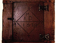
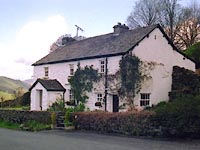
Most houses in the valley would have been built as small farms working the nearby fields, each sited above the river flood-plain, but where there was an unfailing supply of water. Several buildings date from the 17th century. The number of households has hardly changed since the census of 1841.
There is a narrow strip of limestone in the parish where lime was extracted for improving the land. In addition, bracken would have been burnt to produce potash.
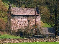
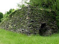
The wool industry was important in the valley and some of the ruins that remain may have been fulling mills.
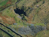
Small quarries abound, some with ruined buildings. The biggest quarry was at
Wrengill but it is now derelict and dangerous. It was famous for its blue slate and had an extensive tramway.
Another industrial enterprise in Longsleddale was
the construction of the underground aqueduct from Haweswater in the mid 20th century.
Old Maps, Pictures and Documents
Longsleddale is marked on Saxton's map of 1576, as "Sleddale" on the river "Sput", and it is shown on later maps. There are a number of old pictures of the valley. Longsleddale is mentioned in documents dating from early in the 13th century, in Latin or English: from 1555 onwards more systematic records are available.
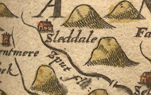
Saxton's map 1576
|
 Old Maps - large scale OS, geological, 18c/19c maps, field names
Old Pictures - prints, paintings, photographs, postcards
Local Records - 1555 to 1911 - from many sources
|
More information can be found online in a website of historic resources in Cumbria:-
For individual places look under their name, or find the parish entry for
Longsleddale, in
Guides to the Lakes - gazetteer