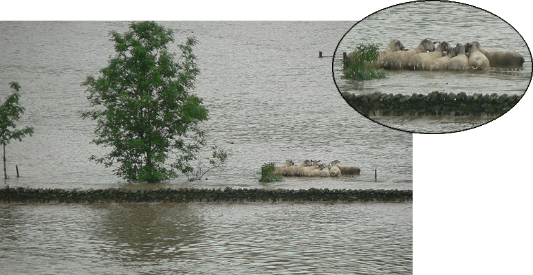
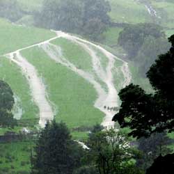
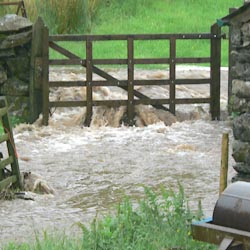
Black Thursday, 28th June 2012, stranded tups near Wadshow - but no casualties!
Black Thursday, 28th June 2012, stranded tups near Wadshow - but no casualties! |
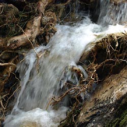
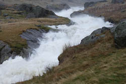 the Sprint near Buckbarrow Crag |
 the view from Wads Howe Bridge |
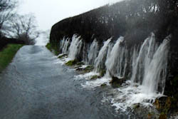 the road near Middale |
| photos courtesy of Margaret Bennet and Jean Norgate | ||
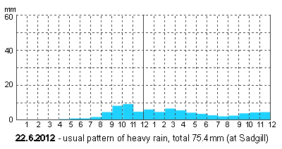 |
Typical heavy rain, easing off after a few hours. |
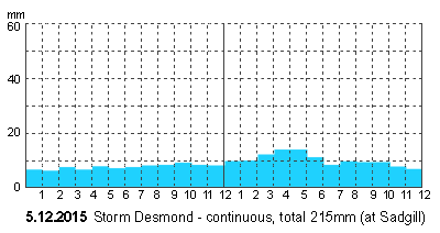 |
Massive total rainfall, the result of steady heavy rain all day and all night. |
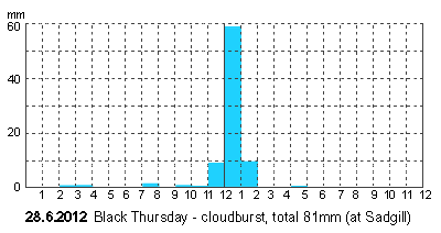 |
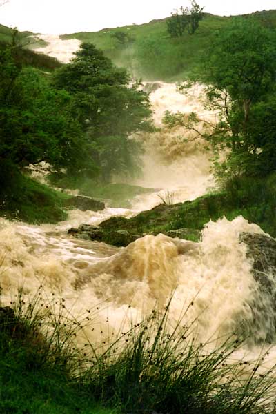
The reason for this dramatic event was not the amount of rain in total that day, but that so much fell in one hour! |
 cascades above Toms Howe |
 the track at Wads Howe |
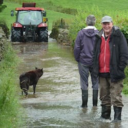 the road near Stockdale |
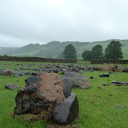 rocks brought down by the torrent |
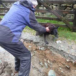 Lily negociating Stile End Track |
 Tills Hole Beck scoured to bedrock |
| photos courtesy of Geoff Plant, Alan Andrews, Lindy Jarvis, Martin Norgate | ||
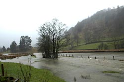
 6th August 2002, Stockdale Beck photo courtesy of Sylvia Fishwick |
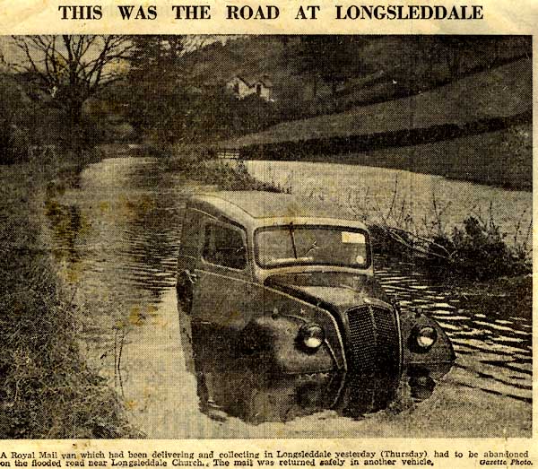 picture courtesy of Margaret Bennet and Westmorland Gazette |
|
| "... At Dale End, Longsleddale, considerable damage has been done. A breast wall three roods long was demolished, also a quantity of fence walling. The beck was so full that it quite covered the bridge. The roads in Longsleddale were quite impassable; near the vicarage the river overflowed into the road and was still there on Thursday. Right up to the top of the valley fences and light bridges have been carried down, and much damage done. On the Flatts above Sadgill the stream was a big lake, whilst the effects of the ghylls down the hillsides was very fine." |
| "School was not opened yesterday. The roads being in many places knee deep in water, neither children or I were able to cross." |
|
"Again the rain descends the valley is flooded. Half the children cannot get to school, the road is blocked unless they come by boat, and a great portion of the grant is paid on the average attendance. We get an extra grant on account of the small population. We need a weather grant to compensate for bad attendance on wet days." (Kendal Record Office : WDS70/1) |
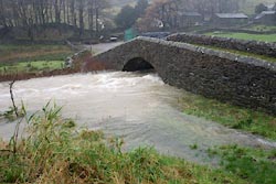 the Sprint at Sadgill Bridge, 19.11.2009 |
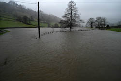
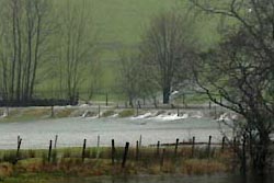 water over the river bank, 22.2.2012 |
 flooded fields near the church, 22.2.2012 |
|
Petition, Robert Wilson, Mathew Munkhouse, Thomas Hall, Thomas Hudson, Robert
Walker and Jonathan Newton of Longsleddale, "in August 1749 a large and
serviceable Stone Bridge within Longsleddale afd. was drove down by violent
Floods which your Petre are liable to rebuild" the said bridge is necessary to
make the highway from Ambleside to Kirkby Stephen passable, petitioners were at
great expense 24 years ago in erecting said bridge and have received
considerable damage by the said floods. Desire bridge to be rebuilt by county or
gratuity. (Summary from Quarter Session Rolls; Kendal, Christmas 1749 :: Kendal Record Office : QS AR/2/13/3 213/18) [This was Wads Howe Bridge, and Ł8 was paid. (QS AR/2/13/3 220/11)] Petition, Michael Mattinson, John Airey and James Anson of Sadgill, Longsleddale, being liable to repair the highway from Kentmere to Longsleddale Head about 14 years ago built a stone bridge at their own expence over the ford at Sadgill, and received a gratuity of Ł5 from Mr Dennison High Constable of Kendal ward, said bridge "abt September last by very violent & sudden Rain was intirely destroy'd & the Corn Hay & other goods of Your Petre were damag'd to the Value of Ł100 & upwards." Desire bridge may be rebuilt or assistance. (Summary from Quarter Session Rolls; Kendal, Christmas 1749 ::Kendal Record Office : QS AR/2/13/3 213/19) Petition, Isaac Goodman, Mary Gibson, Alice Collinson, Anthony Kellet & James Garnet of Longsleddale, that Bitch-hill-Bridge was by the Rapidity of the River in or ab[out] August last intirely destroyed and they have also suffered by the floods about the same time and cannot rebuild bridge without assistance. ... Rejected (Summary from Quarter Session Rolls; Kendal, Easter 1750 :: Kendal Record Office : QS AR/2/13/3 215/23) |
 Longsleddale Home Page
|
